By Dave Allston
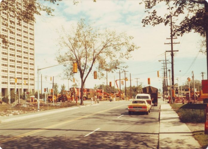
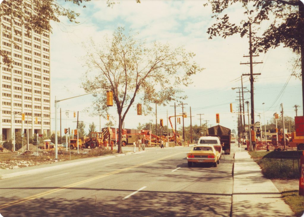
Scott Street is undergoing a significant face lift over the next few years as aged infrastructure is replaced. We are in the midst of a series of short-term modifications of the roadway, with promises of elements of a “complete street” somewhere on the horizon. More significantly, the streetscape of Scott is changing with each new condo development that goes up.
Scott Street, all three kilometres of it, is transforming before our eyes. In fact, few streets in the city have seen so much evolution.
You might be surprised to learn that Scott Street shares the title (at least on paper) of oldest street in Ottawa! When Nepean Township was first surveyed in 1794, Scott Street was laid out as the “road allowance” separating Concession A and Concession 1. It ran in a straight line from the Ottawa River (where the river beds just west of Westboro Beach), all the way to Bronson Avenue (where the downtown grid consists of old Concessions B and C).
As a roadway, it began to take shape as “Ottawa Street.” The name first appeared in 1874 when Robert Hinton subdivided his farm, naming the northern boundary road “Ottawa” and the southern boundary road “Manatick Street” (a.k.a Carling Avenue, then just known as the road that would, eventually, get you to Manotick).
Gradually, as other 19th century landowners along the road laid out their property, they adopted the name “Ottawa Street” as well, to about as far as Holland Avenue.
Beyond the city limits, beginning at Western Avenue out to Churchill, the name adopted was Pacific Street, named for the Canadian Pacific Railway (CPR) line adjacent to it.
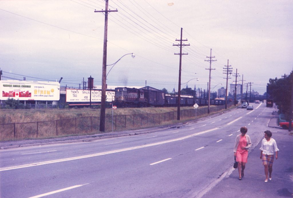
In fact, it was the decision of the Canada Central Railway to run their line along the north side of Scott Street in 1870 that would forever influence the makeup of the neighbourhood. That railway line would remain until 1982 when it was removed, and the deep trench was dug to accommodate the transitway. Just three decades later, it is now home to the LRT. Consistently, through each era, this key feature helped shape the neighbourhoods on both sides, and intertwines closely with the history of Scott Street.
After Hintonburg was annexed to the City of Ottawa in 1907, many of its streets needed to be renamed due to duplication. Residents, land owners and city staff all contributed to the selection of new names. There was already an Ottawa Street in LeBreton Flats, and so the more westerly Ottawa Street had to change. The original name recommended was “Ontario Street,” but, for reasons lost to history, a last-minute change saw “Scott Street” chosen instead in March of 1908. This applied only for the portion within the city limits. The portion west of Western remained Pacific Street until annexation in 1950, when the full length became Scott Street.
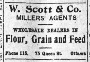
As the Ottawa Land Association owned much of the land from Parkdale to Western along the road, their members were likely the ones to push for the street to be named for their director, William Scott. He had been on the inaugural board of directors when the Ottawa Electric Railway Company first formed in 1891. Scott was also associated with the electric company and the land association (of which the principals of the streetcar and electrical companies were involved with for the obvious investment opportunity along the line). Scott was president of Ottawa’s Board of Trade (1893-1894) and, after years as a director with the Thomas McKay Milling Company, he opened his own grain dealer and brokerage house after the Great Fire of 1900.
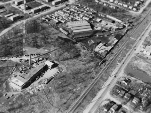
Today, Scott Street is seeing its most staggering changes at the western end. It once stood as one of the west end’s largest industrial areas, but now a few final traces remain.
Some of the more notable spots included the M.N. Cummings lumber business, located on the north side of Scott, just east of Churchill, from 1911 to 1961. Today, the Van Lang apartments and Fieldhouse stand there; the property was razed and sat vacant for 30 years. Another significant Scott Street business was the Independent Coal and Lumber that ran from 1920 to 1970 (now the Metropole building and townhouses, after it too sat empty for 30 years). Many of the west end’s homes were built and heated by materials from these two plants.
Fuller Construction had a large yard between McRae and Clifton for many years, while MacMillan Office Appliances was a familiar spot at the southeast corner of Athlone from 1928 until the mid-1970s.
The Westboro end of Scott Street has seen a variety of other commercial businesses — gas stations, auto repair shops, body shops, Adam’s Moving, Trailhead and more, including the Granite Curling Club which arrived in 1954.
Scott Street has also been home to several other pockets of industry. The Beach Foundry, between Holland and Parkdale Avenues, produced some of Canada’s finest appliances from 1921 to 1981. This location was also home to the Fleck Foundry, prominent Ottawa contractor firm McLaughlin Brothers, Brewer’s Retail and a Texaco gas station over the years. Holland Cross replaced these in 1986.
Other businesses and firms, largely automotive, popped up towards the eastern end, though Scott Street largely retained a residential look in Hintonburg.
Today, Scott Street flows seamlessly over Bayview Road and over the bridge towards City Centre and downtown. However, that bridge is still fairly new — it opened in August 1969 to replace the former Wellington Viaduct that travelled over the original Ottawa West railway yards. Prior to that, Scott came to an end at Bayview, with no eastward connection to Albert Street.
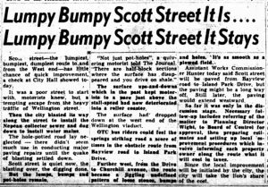
Up until the mid-1950s, this eastern end of Scott Street was used mostly as an access road to the streets of Hintonburg and Mechanicsville, largely an afterthought in the neighbourhood development. Scott was a quiet, two-lane, tree-lined street with a low speed limit (owing to the severe dips and hills in the road). It was not widened to four lanes until 1951. In fact, Scott Street was not even paved until 1953! And, even then, it came from heavy pressure from residents, as well as workers at the new Tunney’s Pasture office buildings who were tired of driving through deep pothole-ridden streets to get to work. In 1955, parking was banned on Scott Street to speed up traffic!
Following paving, the removal of parking and, particularly, once the new bridge to Albert was built, the traffic patterns increased. Along with the trains that were flying by (at as much as 40 miles per hour on the CPR track), road traffic grew substantially. Scott Street became a busy connector — companies battled for billboard space on the CPR fences along the track, creating a lengthy strip of ads through Hintonburg for those travelling by. The amount of gridlock also grew for residents looking to move north, or south, who had to wait for lengthy trains to pass. The area also saw a substantial increase in far-too frequent deadly crashes at the many crossings along Scott.
For its long length, Scott Street has actually had few homes or businesses fronting it, or using a Scott Street address. A handful of houses in Hintonburg and Wellington Village front the busy street — the most notable on the stretch may be the “Gogo houses” between Western and Carleton. The set of six matching houses, built in 1915 by local carpenter Simeon Gogo, still look the same a century later.
This area of Scott in Wellington Village flooded frequently in the first decades of the 20th century. The spring melts, from as far as Carlington, flowed to its low-lying area. Building lots in the young neighbourhood, in proximity to Scott Street, were either unable to be sold or sold for next to nothing, until sewer drainage could solve the issue in 1927. It was so bad that a local resident called the area “without question only fit for industrial purposes and will never be a strictly residential section of the city” in a letter to the Ottawa Citizen in 1919.
Time has indeed shown Scott Street as an increasingly important road. The 1990s saw the largest shift with construction of the Taiga building at 2100 Scott St., the Van Lang and Metropole developments and now the various condo buildings going up at a furious rate. The arrival of the LRT, and the transformation to a complete street, seems to promise that, even ten years from now, there will be few traces of the Scott Street of old.
