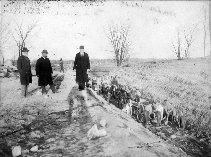
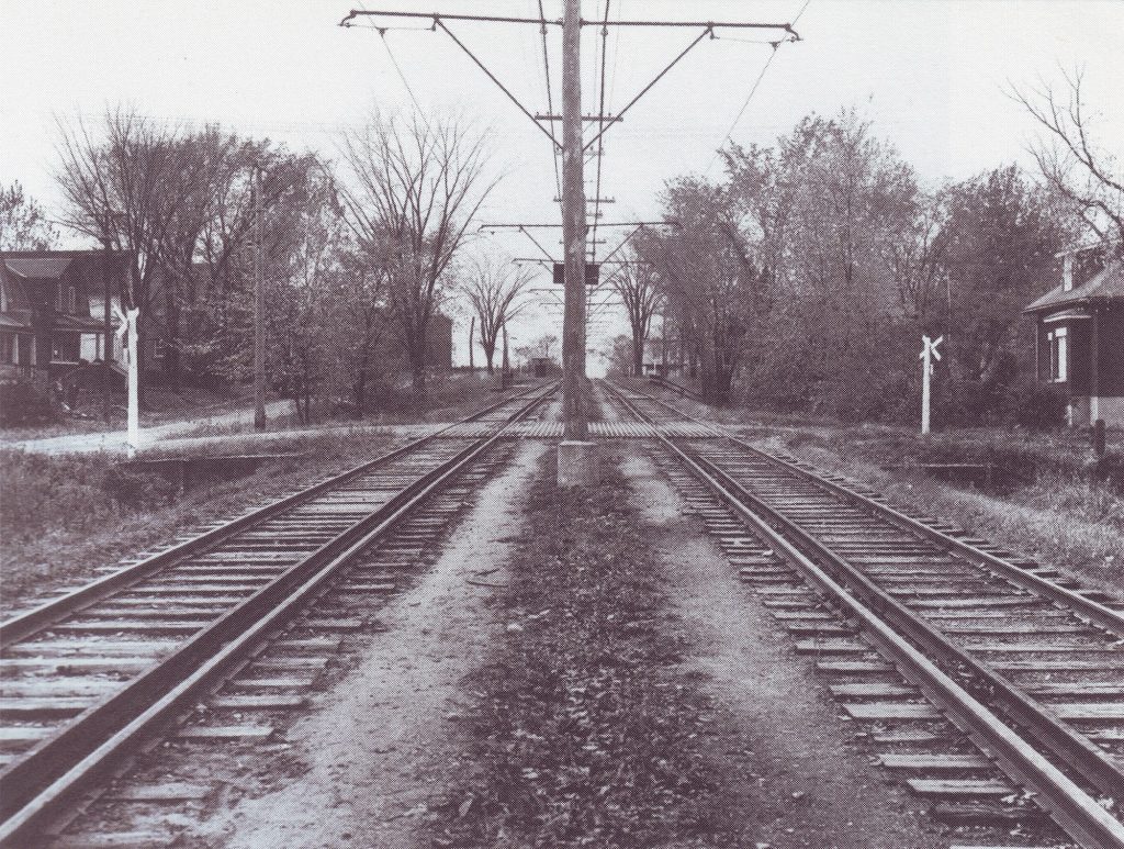
Byron Linear Park is a green space gem in Kitchissippi, a narrow stretch of urban parkland that runs through the heart of several neighbourhoods. But in the early days, the Ottawa Electric Railway used this property.
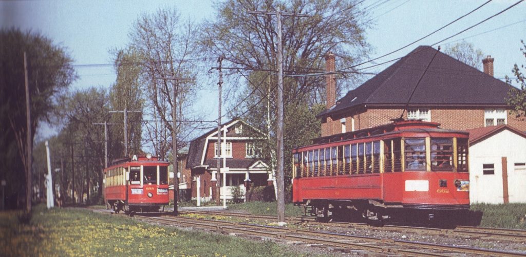
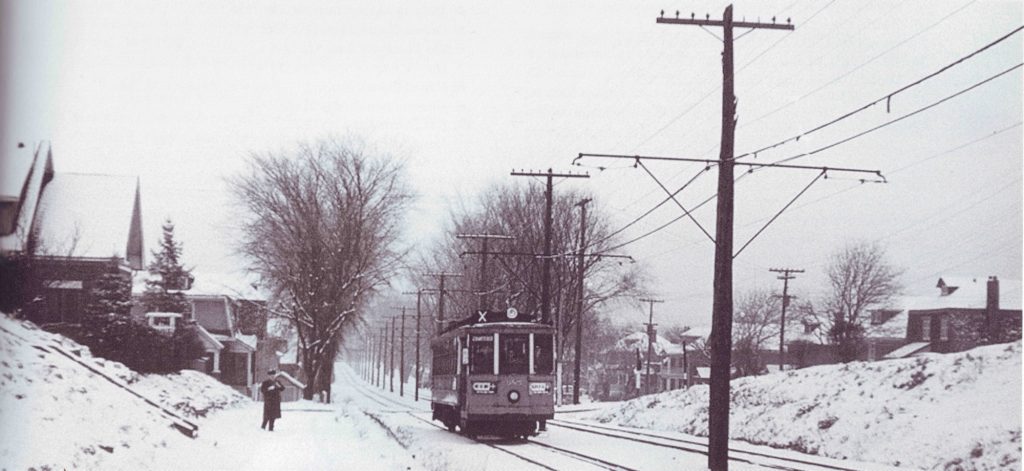
From 1899 to 1959, it was home to a scenic streetcar ride to Britannia Park that not only provided access to a fun concert, dancing and swimming venue, but also helped open up the west end to Ottawa. Farmers in 1899 were happy to provide the land for next to nothing, as their property values increased exponentially with the arrival of public transportation.
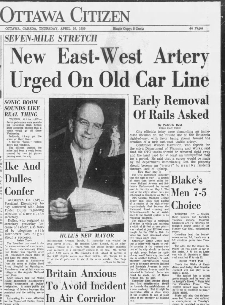
In the 1950s, the City began to plan the phase-out of the expensive streetcar system, moving to buses only. After the streetcars made their final run in May 1959, the City wasted little time pulling up the tracks, but had no concrete plan for what to do with the 33 acres of minimum the 66 foot-wide right-of-way. For the next 20-plus years, the highly-political debate would rage.
As early as mid-1958, Alderman Frank Boyce announced the first plan for the land, proposing that a “wide multi-lane highway to serve the West End” be constructed. “A beautiful thruway could be built all the way from Holland Avenue to Britannia”, he stated, and eventually would link up with the Deschenes Bridge over the Ottawa River at Britannia, which was widely believed to be built one day soon.
It was front page news in January 1959 when this plan was formally announced by Ottawa Mayor George Nelms. Council even began looking at a full-on “cross-city route” from Elgin to Britannia, accomplishable by extending Gladstone through to Parkdale — via expropriation and demolition of houses in the way — and connecting directly with Byron.
The first step the city took was to eliminate the old Byron Avenue jog between Churchill and Roosevelt. What is now Danforth Avenue was once Byron Avenue’s continuation west from Churchill; only streetcar tracks originally ran on the Byron hill west from Churchill today. The new straight-line Byron Avenue opened to traffic Aug. 13, 1960.
A blindsided decision
The most earth-shattering proposal came in June of 1961 when Mayor Charlotte Whitton blindsided council and announced that the City would sell a vast majority of the land, particularly in the area between Churchill and Holland, to private interests.
Whitton proposed to widen Byron Ave, eliminate the dead ends of side streets in Wellington Village by extending them all to Byron, and sell the land alongside as individual building lots. Whitton saw the land sale as an opportunity to help reduce the Ottawa Transportation Commission debt.
“The plan is premature,” said Alderman Howard Henry. “We are not yet in a position to know what we should do with that right-of-way. But we are not going to sell it off to some private builders and then find out we should have kept it, as we did with the McKellar Golf Course.”
Soon, the NCC jumped in and stated they too would object to the sale to private interests.
Meanwhile, the space was left to decay. As early as the fall of 1960, it was being called a “hazard and an eyesore” and a “disgrace for the entrance to the capital city.” The line was overgrown, weed-covered, and still filled with old railway ties, bolts, stone and other garbage. The streets where the streetcar tracks had once traversed were left in disrepair.
The ideas for the right-of-way ranged from the tongue-in-cheek like “the longest and narrowest football field in the world” to “a watered and frozen longest curling rink in the world.” There were more reasonable ideas like a bicycles-only pathway, market gardens, parking for Richmond Road stores and businesses, or even a new location for the Parkdale Market after the opening of the Queensway saw a massive influx of traffic on Parkdale. The Parks and Recreation Department released a 10-year municipal recreation program in the fall of 1964 that included a large new indoor swimming pool facility, to be built on the right-of-way between Huron and Holland.
Early plans for a subway system
In 1967 the City considered constructing a rapid transit system on the same spot they had pulled up the tracks. Following Toronto’s lead, city staff hoped that Ottawa could build a similar, part-underground, part-open system. Mayor Don Reid and city staff visited Montreal during Expo 67 to view the Expo Minirail system, in consideration of buying it and installing it along the full route of the former streetcar line. However, that idea was a no-go. The cars were too small and were open — not suitable for Ottawa weather.
By the late 1970s, Ottawa was closing in on a new transit plan that considered subways and light rail, but eventually settled on a network of dedicated bus routes. The main question was where could these routes run? This ideally-sized strip of land was seen as a perfect Transitway route.
The City and the NCC perennially battled on the subject of buses on the Kitchi Zibi Mikan. Though the NCC had allowed OC buses on the Parkway, it had always been intended to be a short-term measure. Both sides agreed that running the new Transitway down the former streetcar line was the best solution, and in early 1980, it was proposed that the Transitway would run overtop the former streetcar line, to be accessed from Rochester Field, Churchill Avenue, or even as far west as Holland.
The file ended up at the Ontario Municipal Board in April of 1980, where six community associations and many individual residents spoke out against the proposal. Eventually, the different levels of government agreed to keep buses on the Parkway and off the old streetcar line.
A new vision
The City was now free to plan a vehicle-free future for the former right-of-way. In September 1980, the Ottawa planning board announced approval for a $700,000 linear park from Holland to Britannia Park. The initial plans were spectacular. The park was to include paved paths for pedestrians, cyclists and joggers, fitness stations, landscaping to screen homes from traffic noise, benches and seating near bus stops, pathways connecting to the NCC’s pedestrian and bike path system, and even municipal non-profit housing.
The plan was approved by Council on Oct. 1, 1980, narrowly passed by a vote of 9-7. The Park was divided into three sections, with each to be developed according to the needs of the local neighbourhoods.
Consultations in the Wellington Village community saw a request for horseshoe pits, benches and a playground. The Westboro Neighbourhood Study recommended a pedestrian and bicycle route. Meanwhile the city’s non-profit housing corporation proposed apartments to be built at Island Park and Byron, but these never came to fruition.
A spokesman for the McKellar Park Association did not like the proposed bicycle route, as it contained multiple breaks, defeating its purpose. “These proposals mean the park will be like a bike path where you have to use city streets for half a mile,” he said.
The first work order approved was in February 1982, when city staff greenlit $34,418 for an asphalt path from Holland to Churchill, which would eventually be extended to Britannia Park.
Yet in 1982 the city retracted its commitments significantly. The $700,000 committed in 1980 which increased by $100,000 a year later was almost completely cut.
If the community could raise funds, the city would match whatever was raised up to $5,000. Wellington Village residents spent the summer of 1982 canvassing, and running barbeques and garage sales, accumulating $3,000. Work crews were able to install three park benches and planted 42 maple, ash and evergreen trees between Holland and Island Park Drive in October 1982.
An even larger plan came about in 1985, when local residents began to push for a new playground, particularly where preschool-aged children could play. Low on the priority list, residents were told it could be expedited if they contributed money or labour. The Recreation Department agreed to design and pay half the costs of a playground featuring a play locomotive climber, which was completed two years later.
The City sold off large pieces of the right-of-way west of Woodroffe, but eventually paid for basic paths and landscaping for the rest of the park. In December 1984, the planning committee recommended a new Westboro war memorial be erected near Golden Avenue. The City and the Westboro War Memorial Association split the $10,000 cost on this important monument.
